Strategic Growth, Systemic Silence – Stacking the Scales: How South Medstead’s Planning Was Tilted Before the Balance Was Even Applied – v1

đź§ľ The context:


From 2011 to 2023, Medstead alone saw a net gain of 455 new dwellings, with over 500 dwellings added across Medstead and Four Marks combined. A significant share of this growth occurred between 2016 and 2020.

Evidence — including a 2019 development pack by P V Projects Ltd — confirms that this growth was not incidental but part of a strategic expansion plan for South Medstead, known to both EHDC and Bargate Homes as early as 2018. This was when Bargate signed an option agreement on the Beechlands Road site (Land Registry Title No. SH12998).

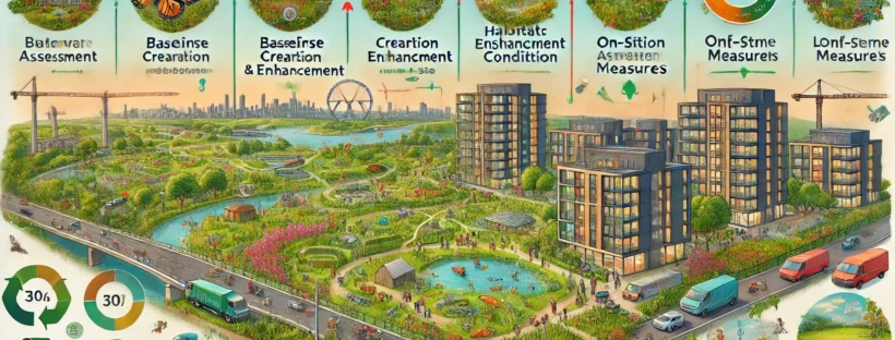
Despite this cumulative expansion and a 38% population increase in the ward (from 6,019 in 2011 to 8,300 in 2021), no Environmental Impact Assessment (EIA) was triggered, and no public consultation was held on the broader plan.

📌 EHDC approved these developments incrementally, treating each application as isolated. This avoided the environmental scrutiny that would have been triggered if the full scale had been disclosed and treated as a strategic expansion.

đź§© Why this is a potential ground for Judicial Review:


⚖️ 1. Illegality – Failure to Apply EIA Law to Cumulative Development

The Town and Country Planning (Environmental Impact Assessment) Regulations 2017 require an EIA for any development:

  • Exceeding 150 dwellings or 5 hectares (Schedule 2, 10(b)); or
  • Where the development “is likely to have significant effects on the environment by virtue of factors such as its nature, size or location” (Reg. 5(1)); and
  • “Where a relevant planning authority is aware that a particular development is likely to have significant effects in combination with other existing or approved development, it must take account of those cumulative effects” (Reg. 5(4)).

📌 EHDC failed to do this. Developments in Medstead were segmented into smaller applications approved over time. No cumulative assessment was carried out — despite housing numbers and growth clearly exceeding the thresholds.

⚖️ 2. Procedural Impropriety – Failure to Disclose Strategic Intent and Monitor Impact

EHDC was aware of the strategic and coordinated nature of the expansion (e.g. via the PV Projects EHDC had access to strategic planning documents (e.g., the 2019 P V Projects pack) identifying South Medstead as a future expansion zone for up to 650 homes — but:

  • Never disclosed this broader vision to the public,
  • Never consulted residents on the cumulative impact, and
  • Never monitored or reported on baseline harms across drainage, roads, biodiversity, or public services.

📌 This constitutes a breach of NPPF Paragraph 132, which requires early, transparent, and effective engagement on developments that affect the wider community.

⚖️ 3. Procedural Impropriety – Fragmentation of Impact Assessment

While each planning application was technically distinct, evidence shows the developments were pre-linked in strategy and intent:

  • Bargate’s 2018 land option confirms foreknowledge,
  • The 2019 PV Projects masterplanning pack confirms intent to deliver up to 650 homes,
  • Yet none of this was shared or acknowledged during planning consultations.

As a result:

  • Residents were kept unaware of the scale of intended growth,
  • Applications avoided baseline impact studies that would trigger EIA, and
  • Local feedback was limited to immediate or cosmetic concerns, rather than strategic objections.

📌 This enabled EHDC to avoid triggering EIA requirements and failed to provide residents with a meaningful opportunity to assess or challenge cumulative adverse impacts (on drainage, safety, biodiversity, or community infrastructure).

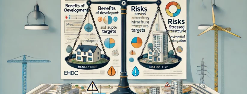
⚖️ 4. Illegality and Irrationality – Tilted Balance Applied Without Baseline Evidence

Under NPPF Paragraph 11(d), permission can be granted when policies are out of date — but only if:

“any adverse impacts of doing so would significantly and demonstrably outweigh the benefits.”

In this case:

  • No EIA was triggered despite cumulative triggers being met,
  • No data was presented to councillors or the public regarding infrastructure strain, environmental degradation, or service shortfalls,
  • And yet, the committee granted permission under the tilted balance — without quantifying or substantiating those adverse impacts.

📌 This is a misapplication of national policy and may render the decision irrational and unlawful.

⚖️ 5. Failure to Give Lawful and Adequate Reasons

Under common law principles and the statutory duty of transparency, planning authorities must provide clear and lawful reasons for granting permission — especially when departing from the Local Plan or relying on the tilted balance.

In this case:

  • The committee’s rationale for approval appears to have relied on:
    • The existence of past approvals (e.g. a 2016 scheme nearby), and
    • The outcome of recent appeals in Four Marks (in 2024 and 2025).
  • Councillors openly expressed doubts about sustainability, but were reassured by the planning officer that “similar developments have been approved on appeal.”

📌 What’s missing:

  • No formal reasons were recorded explaining why the harms — such as infrastructure strain, road safety risks, or ecological pressure — were not significant.
  • No quantified or evidence-based analysis of adverse impacts was provided to justify the tilted balance conclusion.
  • No reasoned explanation of how the benefits were assessed — especially in relation to the actual shortfall in land supply or housing need.

🔍 Summary of Legal Concerns:


This isn’t just a technical omission — it’s a systemic failure of lawful planning:

  • Strategic segmentation of planning applications to evade environmental oversight
  • Developer-led narrative engineering via brochures and pre-app letters
  • A council that, knowingly or not, enabled the strategy without proper public scrutiny

All of this:

  • Prevented a lawful application of the tilted balance,
  • Denied residents a fair and informed consultation, and
  • May render the Beechlands Road approval unlawful under Judicial Review.

âś… Supporting Law and Policy:


Town and Country Planning (EIA) Regulations 2017

  • Schedule 2, 10(b): EIA required for urban development >150 dwellings or 5 hectares.
  • Regulation 5(1) and 5(4): Requires screening where cumulative effects with other developments are likely.

NPPF Paragraph 132:

“Applications that can demonstrate early, proactive and effective engagement with the community should be looked on more favourably.”

NPPF Paragraph 11(d):

Grants permission unless “any adverse impacts of doing so would significantly and demonstrably outweigh the benefits”.

Case Law:

  • R (Burridge) v Breckland DC [2013] EWCA Civ 228:
    Failure to consider cumulative impacts invalidates planning approval.
  • R (Loader) v Rother DC [2016] EWHC 1876 (Admin):
    Unlawful to segment projects to avoid EIA.
  • R (Morge) v Hampshire CC [2011] UKSC 2:
    Emphasises councillors’ responsibility to assess environmental effects fully and transparently.

âś… Supporting Evidence:


  • Land Registry Entry (Title SH12998) confirms that Bargate Homes secured an option agreement on the Beechlands Road site in April 2018, indicating strategic acquisition well before public applications were submitted.
  • P V Projects Ltd Masterplanning Pack (2019) shows that over 650 dwellings were envisioned as part of a long-term development of South Medstead — including Beechlands Road — despite this not being disclosed or consulted upon in official planning documentation.

  • Bargate Homes Sales Brochure (2018): Describes a “walkable countryside lifestyle” while omitting that the village was targeted for significant expansion — and that the promoted amenities required roadside walking without pavements, increasingly hazardous due to the growth being engineered. Many of the “walkable” amenities mentioned require walking along unpaved, increasingly hazardous roads, which are becoming more dangerous due to traffic associated with the very expansion Bargate was planning. The brochure’s omission of this reality highlights the contradiction between marketing and planning intentions and adds weight to claims of misrepresentation and lack of transparency.
  • ONS Population Data via FOI (EHDC, 2024) confirms a 38% population increase in the Four Marks & Medstead ward between 2011 (6,019) and 2021 (8,300) — yet no EIA screening was triggered across this cumulative growth period.
  • FOI – REF-191888-D3L9 – EHDC spreadsheet titled “Dwellings Completions in Four Marks and Medstead between 2011 and 2023 (Apr–Mar) by Parish” confirms over 500 net new dwellings completed during this period — with Medstead alone accounting for 438. No baseline environmental, drainage, or infrastructure assessments were published across the multiple applications contributing to this total.

Under the UK Town and Country Planning (Environmental Impact Assessment) Regulations 2017, the requirements for an Environmental Impact Assessment (EIA) are specifically outlined

Schedule 1 Projects


These projects always require an EIA due to their significant environmental effects. Examples include large-scale power plants, chemical works, and large infrastructure projects.

Schedule 2 Projects Relevant to Residential Developments


These projects may require an EIA if they are likely to have significant environmental effects due to factors such as their nature, size, or location. The thresholds and criteria for Schedule 2 projects are more specific.

The following thresholds apply to urban development projects, including residential developments:

Projects involving the development of land where the area of the development exceeds 1 hectare.

Projects involving the construction of more than 150 dwellings.

Projects where the overall area of the development exceeds 5 hectares.

Example Application


Urban Setting: A proposed development of 160 dwellings in an urban area would exceed the threshold and thus would typically require an EIA.

Rural Setting: A proposed development of 40 dwellings on a 6-hectare site in a village might require an EIA, particularly if the local authority considers the potential for significant environmental effects.

Schedule 3: Selection Criteria for Screening Schedule 2 Development


The criteria for determining whether a Schedule 2 project requires an EIA include:

The size and design of the whole development.

Consideration of the cumulative effects with other projects.

The UK regulations do indeed account for cumulative significance when assessing whether an EIA is required. The consideration of cumulative impacts ensures that the full environmental effect of multiple projects is evaluated, providing a more comprehensive assessment of potential environmental impacts.

Key Points on Cumulative Effects:

1. Cumulative Effects:

  • The potential for a project to have a significant impact when combined with other existing or approved projects. This can include a wide range of factors such as increased traffic, pollution levels, or changes to the landscape.

    2. Screening Process:

    • During the screening process, the local planning authority must consider whether the project, in combination with other projects, is likely to have significant effects on the environment. This includes both current and future projects.

      3. Regulation References:

      • Regulation 4(6): Requires consideration of the direct effects and any indirect, secondary, cumulative, short, medium, and long-term, permanent and temporary, positive and negative effects of a project.

        The existing land use, the relative abundance, quality, and regenerative capacity of natural resources in the area, and the absorption capacity of the natural environment.


        Hedgerows


        Lines of hedgerows dotted with trees are characteristic of the British countryside.
        Credit: David Noton Photography / Alamy Stock


        What is a hedgerow?

        A hedgerow refers to a line of bushes, shrubs, or trees, often interspersed with grasses or other vegetation, that typically forms a boundary or barrier between fields or properties in rural areas of Britain.

        Hedgerows serve various purposes, including marking property boundaries, providing habitats for wildlife, and offering windbreaks for crops.

        They are a distinctive feature of the British countryside and have been historically significant in agriculture and land management.


        Hedgerows are particularly important for species vulnerable to extinction in the UK, such as the Hazel Dormouse, providing breeding and hibernation habitats, food resources, and enabling populations to move through the landscape.

        Visit the Woodland Trust’s page to find out more about the Hazel Dormouse.


        The hazel dormouse hibernates on the ground during the winter months.
        Credit: Wild Dates Photography / Alamy Stock


        Rural hedges are often a mix of shrub and tree species, such as hawthorn, blackthorn, hazel, ash and oak.


        In more urban and landscaped settings, they are likely to include species like box, yew, privet and holly.


        Glossary


        Appealing a Planning Approval: Options for Third Parties e.g., Neighbours, Community Groups

        While third parties cannot directly appeal the approval of a planning application, there are several legal and procedural avenues to challenge the decision. These include judicial review, complaints to the Local Government Ombudsman, and requesting a call-in by the Secretary of State. Each of these options focuses on ensuring that the decision-making process was lawful and procedurally correct.

        Authority Monitoring Report (AMR)

        The Authority Monitoring Report (AMR) is a document produced annually by local planning authorities in the United Kingdom. It monitors and reports on the implementation and effectiveness of local planning policies and the progress made towards achieving the objectives set out in the local development plan.


        The AMR has two purposes:

        • To monitor progress towards local development documents.
        • To monitor the effectiveness of policies set out in local development document.

        Biodiversity Net Gain (BNG)

        Biodiversity Net Gain (BNG) is a principle and practice within environmental management and planning aimed at ensuring that development projects leave the natural environment in a measurably better state than it was before. This concept focuses on enhancing habitats and ecosystems, thereby increasing biodiversity rather than just mitigating harm.

        Community Infrastructure Levy (CIL)

        Purpose The Community Infrastructure Levy (CIL) is a standard charge that local authorities can levy on new developments to fund broader infrastructure projects. Key Features Process

        Criteria for Referring Applications to the Planning Committee

        In many local planning authorities, including East Hampshire District Council (EHDC), certain types of planning applications are indeed referred to the Planning Committee rather than being decided by planning officers under delegated powers.

        Defra Biodiversity Metric 3.0

        Defra Biodiversity Metric 3.0 is a tool developed by the UK Department for Environment, Food & Rural Affairs (Defra) and Natural England to measure and account for biodiversity losses and gains resulting from development or changes in land management. This metric is crucial for ensuring that new developments achieve Biodiversity Net Gain (BNG), meaning they leave the natural environment in a better state than before.

        Differences Between Outline Planning Permission and Reserved Matters

        This two-stage process allows for initial flexibility while ensuring that detailed scrutiny and public consultation occur before the final development proceeds.

        Emerging Local Plan

        An “emerging Local Plan” is a new or updated plan that is currently being developed but has not yet been formally adopted.

        Five Year Housing Land Supply (5YHLS)

        The 5YHLS represents the quantity of land that has been identified as suitable and available for housing development over a five-year period.

        FP18 and FP19

        The references “FP18” and “FP19” specifically pertain to public footpaths numbered 18 and 19 in the local area. Public footpaths are designated paths that provide public right of way on foot, often through rural or semi-rural areas. These footpaths are typically managed by local authorities and are crucial for providing pedestrian access to various amenities and recreational areas.

        In the context of the objection document, the mention of “FP18” and “FP19” indicates specific public footpaths that will be materially impacted by the proposed development. Here is what it means in detail:

        Full Planning Application Process

        A full planning application seeks detailed planning permission for a development proposal, including all aspects of the design, layout, and landscaping.

        Health Contributions Approach

        The Health Contributions Approach entails securing financial contributions from developers towards the expansion or enhancement of healthcare infrastructure. This is often facilitated through Section 106 agreements or the Community Infrastructure Levy (CIL).

        Housing Delivery Test (HDT)

        The Housing Delivery Test (HDT) is a measure introduced by the UK government to assess the performance of local planning authorities in delivering new homes. It compares the number of homes required to be built in a local authority area against the number of homes actually delivered over a three-year period.

        Housing Targets

        Housing targets are specific goals set by government authorities to ensure an adequate supply of housing to meet the needs of the population. These targets aim to address issues such as population growth, housing affordability, and urban development. Here’s a detailed explanation of housing targets: Purpose of Housing Targets Setting Housing Targets Housing targets are … Continue reading Housing Targets

        Material Planning Considerations: Air and Water Quality

        Air and Water Quality considerations focus on assessing and mitigating the impacts of a proposed development on the quality of air and water resources. These considerations ensure that new developments do not negatively affect the health, safety, and well-being of residents, ecosystems, and the environment.

        Material Planning Considerations: Design and Appearance

        Design and Appearance in the context of material planning considerations refer to the aesthetic, functional, and contextual attributes of a proposed development. These considerations ensure that new developments are visually appealing, functionally appropriate, and harmoniously integrated into the existing built and natural environment.

        Material Planning Considerations: Economic Benefits

        Economic Benefits considerations focus on evaluating the positive impacts that a proposed development might have on the local, regional, or national economy. These considerations ensure that new developments contribute to economic growth, job creation, investment, and overall economic stability and prosperity.

        Material Planning Considerations: Environmental Impact

        Environmental Impact refers to the effect that a proposed development may have on the natural environment. This consideration is crucial for ensuring that new developments do not adversely affect ecosystems, biodiversity, natural resources, and the overall quality of the environment.

        Material Planning Considerations: Flood Risk

        Flood Risk considerations focus on the potential for flooding and the adequacy of measures to prevent and mitigate flood impacts. These considerations ensure that new developments are appropriately located and designed to minimize flood risk to property, people, and the environment.

        Material Planning Considerations: Heritage and Conservation

        Heritage and Conservation considerations focus on the protection and enhancement of historic and culturally significant buildings, structures, landscapes, and areas. These considerations ensure that new developments respect and preserve the historical and architectural integrity of heritage assets while contributing to the area’s overall character and identity.

        Material Planning Considerations: Infrastructure and Services

        Infrastructure and Services considerations focus on the availability, capacity, and adequacy of essential services and facilities required to support a proposed development. This includes transportation networks, utilities, healthcare, education, and other public services necessary for the well-being and functionality of a community.

        Material Planning Considerations: Land Use

        Land Use refers to the management and modification of natural environments or wilderness into built environments such as settlements and semi-natural habitats. In the context of material planning considerations, land use focuses on the suitability and appropriateness of a particular piece of land for the proposed development, considering existing zoning laws, local plans, and the broader impacts on the community and environment.

        Material Planning Considerations: Local and National Planning Policies

        Local and National Planning Policies are critical frameworks that guide the development and use of land in a manner that promotes sustainable growth, protects the environment, and meets the needs of communities. These policies are established at different levels of government and provide specific guidelines and regulations that must be adhered to when considering planning applications.

        Material Planning Considerations: Public Opinion

        Public Opinion refers to the views and concerns of the community, residents, businesses, and other stakeholders regarding a proposed development. When evaluating planning applications, planning authorities consider public opinion to ensure that developments are responsive to the needs and values of the community and to enhance democratic participation in the planning process.

        Material Planning Considerations: Residential Amenity

        Residential Amenity refers to the overall quality of life and comfort experienced by residents in their homes and neighbourhoods. When evaluating planning applications, authorities consider how a proposed development will impact the living conditions of nearby residents and the general ambiance of the area.

        Material Planning Considerations: Sustainability

        Sustainability in planning involves ensuring that developments meet the needs of the present without compromising the ability of future generations to meet their own needs. This consideration encompasses a range of economic, environmental, and social factors aimed at promoting long-term ecological balance, resource efficiency, and quality of life.

        Material Planning Considerations: Traffic and Access

        Traffic and Access are critical factors in evaluating planning applications. These considerations focus on the impact a proposed development will have on the local transportation network, road safety, accessibility for all users, and the adequacy of infrastructure to support the development.

        Meaning of ‘When Assessed Against the NPPF as a Whole’

        The phrase “when assessed against the NPPF as a whole” means that any decision regarding whether the adverse impacts of a development outweigh its benefits should be made by considering the entire set of policies and principles outlined in the National Planning Policy Framework (NPPF).

        National Planning Policy Framework (NPPF)

        The National Planning Policy Framework (NPPF) is a key document that sets out the government’s planning policies for England and how these are expected to be applied. It provides a framework within which local councils can produce their own distinctive local and neighbourhood plans, which reflect the needs and priorities of their communities.

        NPPF, Paragraph 11: Why EHDC’s Failure to Maintain an Up-to-Date LDP and Meet Land Supply Targets Puts Us All at Risk

        The NPPF establishes a presumption in favour of sustainable development. When the local plan is outdated, this presumption is particularly significant.

        Outline Planning Application Process

        An outline planning application seeks to establish whether the scale and nature of a proposed development would be acceptable before a detailed design is put forward

        Planning Application Appeal Process

        The planning application appeal process allows applicants to challenge a local planning authority’s (LPA) decision to refuse planning permission, impose conditions, or fail to make a decision within the statutory period.

        PRESUMPTION IN FAVOUR OF SUSTAINABLE DEVELOPMENT (NPPF PARAGRAPH 11)

        This means that planning permission should be granted unless the adverse impacts of doing so would significantly and demonstrably outweigh the benefits when assessed against the policies in the NPPF as a whole.

        Proven Five Year Housing Land Supply

        The term “proven Five Year Housing Land Supply” refers to a measure used in urban planning and development to ensure an adequate supply of land for housing construction over a specified period, usually five years.

        Public Rights of Way (PRoW)

        Public Rights of Way (PRoW) in the UK are legally protected pathways that allow the public to travel across private and public land.

        There are several types of public rights of way, each with specific legal definitions and uses: Footpaths, Bridleways, Byways Open to All Traffic (BOATs), Restricted Byways.

        Regulation 18 Stage

        At this stage, the local planning authority (LPA) notifies and consults stakeholders and the public on the proposed content of the Local Plan. It is an early stage where feedback is sought to shape the final plan.

        Reserved Matters Application (Following Outline Approval)

        Reserved Matters are specific details of a proposed development that are not decided when outline planning permission is initially granted. These details are “reserved” for later consideration and approval by the local planning authority (LPA). The outline planning permission establishes the principle of the development, while Reserved Matters applications provide the specifics.

        Rural Planning: Approvals Outside Local Development Plans and Settlement Boundaries

        Planning applications outside the Local Development Plans and settlement boundaries in rural England can be approved based on several key factors:

        Section 106 Agreements

        When the relevant development plan policies for the planning application are out-of-date, permission is granted unless it can be proven that the adverse impacts of doing so would significantly and demonstrably outweigh the benefits when assessed against the NPPF as a whole.

        When a local authority cannot demonstrate a five-year housing land supply or fails the Housing Delivery Test, there is a presumption in favour of granting planning permission for development.

        Exception to the Presumption:

        Adverse Impacts Test:

        This presumption in favour of sustainable development can be overridden if it can be shown that the adverse impacts of granting permission would significantly and demonstrably outweigh the benefits. This assessment must be made in the context of the NPPF as a whole.

        Contextual Assessment:

        The decision-maker must consider all relevant NPPF policies, including those related to environmental protection, infrastructure, design quality, and community well-being. If the cumulative adverse impacts in these areas are severe enough, they can justify refusing the application despite the presumption in favour of development.

        Settlement Policy Boundaries (SPBs)

        Benefits:

        • Protection of Countryside: SPBs help protect rural areas from inappropriate development, preserving green spaces and the natural environment.
        • Focus on Urban Areas: By concentrating development within SPBs, local authorities can focus on revitalizing and improving urban areas, making better use of existing services and infrastructure.
        • Clarity and Certainty: SPBs provide clarity and certainty for developers, landowners, and the public about where development is likely to be acceptable and where it is not.

        Sustainable Drainage Systems (SuDS)

        Sustainable Drainage Systems (SuDS) are a collection of water management practices designed to mitigate the adverse effects of urban stormwater runoff and promote the natural water cycle. The primary objectives of SuDS are to manage surface water sustainably, enhance water quality, and provide amenity and biodiversity benefits. Key Components and Objectives of SuDS Common SuDS … Continue reading Sustainable Drainage Systems (SuDS)

        The term “zone of influence of all development proposals” refers to the geographical area that is affected by a proposed development

        The “zone of influence of all development proposals” is a comprehensive concept that encompasses all areas affected by a proposed development. Properly identifying and assessing this zone is critical to ensuring that the development is sustainable, that all potential impacts are managed, and that the needs and concerns of all affected stakeholders are addressed.

        Tilted Balance

        The core aim is to promote sustainable development. Even if a development has some negative impacts, it may still be approved if the overall benefits, particularly in terms of sustainability, are deemed greater.

        To count towards the proven Five Year Housing Land Supply, the planning approval must refer to land that meets certain criteria

        To count towards the proven Five Year Housing Land Supply, planning approval must refer to land that meets certain criteria. These criteria include deliverability, suitability, availability, achievability, and compliance with the National Planning Policy Framework (NPPF). Ensuring these criteria are met is essential for maintaining a robust and effective housing supply strategy that balances development needs with community and environmental considerations. This ensures that proposed developments are realistic, viable, and beneficial for both the local area and the wider region.

        Water Butts

        Water butts are large containers designed for collecting and storing rainwater, typically from the roof via downpipes. This stored water can then be used for various purposes, primarily in gardening and landscaping, to reduce the use of mains water. Key Features and Benefits Installation and Maintenance Water butts are a practical and environmentally friendly way … Continue reading Water Butts

        🏠 What are household projections based on?

        The household growth projections used in the standard method are produced by the Office for National Statistics (ONS) (or previously, the Ministry of Housing, Communities and Local Government). These projections estimate how many new households (not just people) are expected to form in each local area over time — typically over a 25-year period. The … Continue reading 🏠 What are household projections based on?

        📊 What is the standard method for calculating housing need?

        Minimum Annual Housing Need = ➡️ Baseline household growth + ➡️ Uplift based on local affordability


        References for Current Planning Applications

        Planning Application 27000/005: Land to the rear and including Fair Winds, 61 Lymington Bottom Road, Medstead, Alton

        Work In Progress
        —-
        Proposal: 53 Dwellings with Vehicular Access
        Case Officer: Samantha Owen
        Developer: Bewley

        Planning Application 55318/001: Land west of Beechlands Road, South Medstead, Alton

        Work In Progress
        —-
        Proposal: 70 Dwellings with Vehicular Access
        Case Officer: Samantha Owen
        Developer: Bargate Homes